The planning agency (Bappeda) of North Kalimantan Province together with FORCLIME and WWF Indonesia conducted a coordination meeting on 5-6 June 2017 in Tarakan. The meeting aimed to establish synergies amongst stakeholders in data collection of fishponds at the Delta Kayan area. Ultimately, collecting the data will lead to maintain the ecological, economic and socio-cultural sustainability of the Delta Kayan Area. Forty participants represented the North Kalimantan Provincial Government (Kaltara), Fisheries and Fishermen Association, fishery companies, FORCLIME and WWF Indonesia.
In his speech, the Bappeda official highlighted that fishponds in Delta Kayan cover about 140,000 hectares in an area, which is administratively spread over three districts (Bulungan, Tana Tidung, Nunukan) and one city (Tarakan). About 50% of the total pond area is located on land used for forestry purposes. Pond mapping is the first step towards legal assurance, which leads to business surety - a precondition for the certification of fishery products from Kaltara and essential for gaining access to the international market.
The keynote speaker, Secretary of the Province of Kaltara drew attention to the ratification of the Kaltara Provincial Spatial Plan (RTRWP). Currently, Kaltara is working with the Geospatial Information Agency (BIG) to develop a One Map Policy Programme. The results of the mapping of pond land will be integrated into the RTRWP and the One Map Policy Programme.
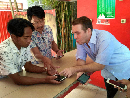
On the second day, FORCLIME and WWF Indonesia advisers introduced a non-paid Global Positioning System (GPS) application. Once the participants started using it, they successfully managed to coordinate retrieval practices using the software.
The meeting will be followed up by a three-day training on mapping and GPS, which will be conducted after the Lebaran holidays. The training will be supported by trainers from FORCLIME and WWF Indonesia and attended by representatives of the Association of Fisheries and Fishermen.
For more information, please contact:
Edy Marbyanto, Strategic Area Manager for Human Capacity Development
Muhammad Sidiq, Provincial Coordinator, North Kalimantan
Robbie Weterings, Adviser for GIS


